PHYSICAL GEOGRAPHY


Gist


Key Components

• Landforms: The Earth's surface features like mountains, plateaus, plains, rivers, lakes, and oceans.

• Geomorphology: The study of how landforms are created, altered, and destroyed through geological processes like weathering, erosion, and tectonic plate movement.

• Climate: The average weather conditions of a place, influenced by factors like latitude, altitude, proximity to water bodies, and prevailing wind patterns.

• Weather: The day-to-day atmospheric conditions including temperature, precipitation, wind, and humidity.

• Hydrology: The study of water distribution and movement on Earth, including surface water (rivers, lakes, oceans) and groundwater. Importance in Ecology

Provides the physical framework for ecosystems

• Landforms influence soil types, drainage patterns, and microclimates, impacting the distribution of plants and animals.

• Climate determines the temperature, precipitation, and seasonality that shape ecosystems.

• Water availability is crucial for all life forms and is influenced by hydrological processes. Understanding physical geography is crucial for

• Biodiversity conservation: Identifying and protecting critical habitats for various species.

• Natural resource management: Utilizing resources like water and minerals sustainably.

• Mitigation and adaptation to climate change: Understanding how changing climate patterns might affect physical landscapes and ecosystems. Examples

• Deserts: Arid regions with limited rainfall, characterized by specific plant and animal adaptations.

• Coral reefs: Marine ecosystems formed by calcium carbonate-secreting organisms, providing vital habitat for diverse marine life.

• Tropical rainforests: Lush, dense forests with abundant rainfall and year-round warmth, supporting a rich diversity of plant and animal life.

• Overall, physical geography forms the foundation upon which ecological processes unfold. Understanding the interplay between physical landscapes and ecological systems is vital for both environmental science and responsible human interactions with our planet.


Summary


Physical geography is a multidisciplinary field focused on understanding the Earth's natural environment. It encompasses subfields such as geomorphology, climatology, biogeography, hydrology, and soil science. Key concepts include plate tectonics, weathering and erosion, atmospheric circulation, the hydrological cycle, and biogeochemical cycles. Physical geographers employ methods like remote sensing, GIS, fieldwork, laboratory analysis, and numerical modeling to study natural phenomena and analyze spatial patterns. The field has diverse applications, including natural hazard assessment, resource management, climate change research, environmental monitoring, and geospatial analysis. Overall, physical geography plays a vital role in advancing our understanding of the Earth system and addressing environmental challenges.


Detailed content


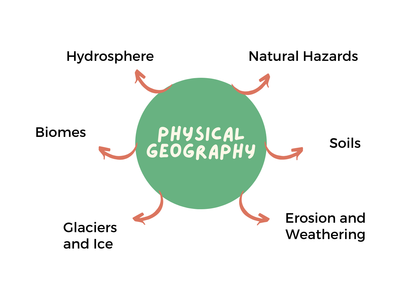
Introduction to Physical Geography

Physical geography is concerned with examining the Earth's physical features and processes, emphasizing their spatial patterns and relationships. It investigates the mechanisms driving natural phenomena, ranging from the formation of mountains and rivers to the distribution of ecosystems and climate zones. By analyzing the interactions between different components of the Earth system, physical geographers strive to elucidate the underlying principles governing environmental dynamics.

Historical Development

The roots of physical geography can be traced back to ancient civilizations, where early societies observed and documented natural phenomena. Ancient Greeks, such as Eratosthenes and Strabo, made significant contributions to geographical knowledge, laying the groundwork for understanding Earth's physical characteristics. During the Renaissance, advancements in cartography and exploration led to a more systematic study of the Earth's surface. The development of scientific methods in the 19th and 20th centuries further propelled the discipline, enabling researchers to conduct detailed investigations into various aspects of physical geography.

Subfields of Physical Geography

• Geomorphology: Geomorphology examines the formation and evolution of landforms, including mountains, valleys, rivers, and coastlines. It investigates the processes of erosion, weathering, and tectonic activity that shape the Earth's surface over time. Geomorphologists utilize field observations, remote sensing techniques, and computer modeling to analyze landscape dynamics.

• Climatology: Climatology studies the Earth's climate system, encompassing patterns of temperature, precipitation, atmospheric circulation, and climate variability. It explores the factors influencing climate, such as solar radiation, greenhouse gases, ocean currents, and topography. Climatologists employ various tools, including climate models and statistical methods, to assess past trends and predict future climate change.

• Biogeography: Biogeography investigates the distribution of plants, animals, and ecosystems across different geographic regions. It examines the factors influencing species distribution, such as climate, habitat suitability, and dispersal mechanisms. Biogeographers study patterns of biodiversity and ecosystem dynamics, addressing conservation and management challenges in the face of environmental change.

• Hydrology: Hydrology focuses on the study of water in the Earth system, including its distribution, movement, and properties. It examines processes such as precipitation, evaporation, infiltration, and runoff, as well as the interactions between surface water, groundwater, and the atmosphere. Hydrologists employ field measurements, remote sensing technologies, and mathematical models to assess water resources and address water-related issues.

• Soil Science: Soil science investigates the formation, composition, and properties of soils, as well as their roles in supporting plant growth, regulating water flow, and cycling nutrients. It explores factors such as parent material, climate, topography, and biological activity that influence soil development. Soil scientists analyze soil profiles, conduct laboratory experiments, and use geospatial techniques to map soil distribution and quality. Key Concepts and Processes

• Plate Tectonics: Plate tectonics is a fundamental concept in physical geography that explains the movement of the Earth's lithospheric plates. It describes processes such as continental drift, seafloor spreading, and subduction, which result in the formation of mountains, earthquakes, and volcanic activity. Plate tectonics influences landscape formation, climate patterns, and the distribution of natural resources.

• Weathering and Erosion: Weathering and erosion are processes that break down and transport rocks and sediments on the Earth's surface. Weathering involves the physical disintegration and chemical alteration of rocks due to exposure to water, wind, temperature changes, and biological activity. Erosion refers to the removal and transportation of weathered materials by agents such as rivers, glaciers, wind, and waves. These processes shape landforms and contribute to soil formation.

• Atmospheric Circulation: Atmospheric circulation refers to the large-scale movement of air in the Earth's atmosphere, driven by differences in temperature and pressure. It includes phenomena such as the Hadley, Ferrel, and Polar cells, as well as global wind patterns and regional climate systems. Atmospheric circulation influences weather patterns, precipitation regimes, and climatic zones across the planet.

• Hydrological Cycle: The hydrological cycle describes the continuous movement of water between the atmosphere, hydrosphere, lithosphere, and biosphere. It involves processes such as evaporation, condensation, precipitation, infiltration, runoff, and groundwater flow. The hydrological cycle regulates the distribution of freshwater resources, shapes landscapes through erosion and deposition, and influences climate patterns. Methods and Techniques

Physical geographers employ a variety of methods and techniques to investigate natural phenomena and analyze spatial patterns. These include:

• Remote Sensing: Remote sensing involves the acquisition of information about the Earth's surface from a distance, using aerial photography, satellite imagery, and other sensor technologies. It allows researchers to monitor changes in land cover, assess environmental conditions, and analyze landscape dynamics over large spatial scales.

• GIS (Geographic Information Systems): GIS integrates spatial data with attribute information to create maps, analyze patterns, and model geographic phenomena. It enables physical geographers to visualize spatial relationships, conduct spatial analysis, and make informed decisions about resource management and environmental planning.

• Fieldwork: Fieldwork involves direct observation, data collection, and measurement of physical features and processes in the natural environment. Physical geographers conduct field surveys, collect soil and water samples, and record environmental data using instruments such as GPS (Global Positioning System), drones, and weather stations.

• Laboratory Analysis: Laboratory analysis allows physical geographers to study soil, water, and atmospheric samples in controlled settings. It involves chemical, physical, and biological tests to analyze properties such as soil texture, water quality, and air composition. Laboratory techniques complement field observations and provide detailed insights into environmental processes.

• Numerical Modeling: Numerical modeling involves the use of mathematical models to simulate physical processes and predict environmental outcomes. Physical geographers develop models of climate systems, hydrological processes, and landscape evolution to explore hypothetical scenarios and understand complex interactions within the Earth system.

Conclusion

Physical geography is a dynamic and interdisciplinary field that explores the natural processes shaping the Earth's surface and environment. By examining the interactions between the atmosphere, hydrosphere, lithosphere, and biosphere, physical geographers seek to understand the complexities of the Earth system and address environmental challenges facing our planet. Through innovative research, advanced technologies, and collaborative efforts, physical geography continues to contribute valuable insights into the dynamics of our natural world, informing policies and practices aimed at promoting sustainability and resilience.


தமிழில் விரிவான உள்ளடக்கம்


இயற்பியல் புவியியல் அறிமுகம்

இயற்பியல் புவியியல் என்பது பூமியை ஆராய்வதில் அக்கறை கொண்டுள்ளது உடல் அம்சங்கள் மற்றும் செயல்முறைகள், அவற்றின் இடஞ்சார்ந்த வலியுறுத்துதல் வடிவங்கள் மற்றும் உறவுகள். இது ஓட்டும் வழிமுறைகளை ஆராய்கிறது இயற்கை நிகழ்வுகள், மலைகளின் உருவாக்கம் மற்றும் சுற்றுச்சூழல் அமைப்புகள் மற்றும் காலநிலை மண்டலங்களின் விநியோகத்திற்கு ஆறுகள். மூலம் பல்வேறு கூறுகளுக்கு இடையிலான தொடர்புகளை பகுப்பாய்வு செய்தல் பூமி அமைப்பு, இயற்பியல் புவியியலாளர்கள் தெளிவுபடுத்த முயற்சி செய்கிறார்கள் சுற்றுச்சூழல் இயக்கவியலைக் கட்டுப்படுத்தும் அடிப்படைக் கொள்கைகள்.

வரலாற்று வளர்ச்சி

இயற்பியல் புவியியலின் வேர்கள் பழங்காலத்திலிருந்தே காணப்படுகின்றன நாகரிகங்கள், அங்கு ஆரம்பகால சமூகங்கள் அவதானித்து ஆவணப்படுத்தப்பட்டன இயற்கை நிகழ்வுகள். பண்டைய கிரேக்கர்கள், எரடோஸ்தீனஸ் மற்றும் ஸ்ட்ராபோ, புவியியல் அறிவுக்கு குறிப்பிடத்தக்க பங்களிப்பைச் செய்தார், பூமியின் பௌதீகத்தைப் புரிந்துகொள்வதற்கான அடித்தளத்தை அமைத்தல் பண்புகள். மறுமலர்ச்சியின் போது, முன்னேற்றங்கள் வரைபடவியல் மற்றும் ஆய்வு ஆகியவை இன்னும் முறையான ஆய்வுக்கு வழிவகுத்தது பூமியின் மேற்பரப்பு. 19 இல் அறிவியல் முறைகளின் வளர்ச்சி மற்றும் 20 ஆம் நூற்றாண்டுகள் ஒழுக்கத்தை மேலும் தூண்டியது, செயல்படுத்தியது ஆராய்ச்சியாளர்கள் பல்வேறு ஆய்வுகளை மேற்கொள்ள வேண்டும் இயற்பியல் புவியியலின் அம்சங்கள்.

உடல் புவியியலின் துணைப் புலங்கள்

• புவியியல்: புவியியல் அமைப்பு உருவாக்கம் மற்றும் மலைகள், பள்ளத்தாக்குகள், ஆறுகள் மற்றும் நிலப்பரப்புகளின் பரிணாமம் கடற்கரையோரங்கள். இது அரிப்பு, வானிலை, செயல்முறைகளை ஆராய்கிறது. காலப்போக்கில் பூமியின் மேற்பரப்பை வடிவமைக்கும் டெக்டோனிக் செயல்பாடு. புவியியல் வல்லுநர்கள் புல கண்காணிப்பு, தொலைநிலை உணர்தல் ஆகியவற்றைப் பயன்படுத்துகின்றனர் நுட்பங்கள் மற்றும் நிலப்பரப்பை பகுப்பாய்வு செய்வதற்கான கணினி மாடலிங் இயக்கவியல்.

• காலநிலை: காலநிலையியல் பூமியின் காலநிலையை ஆய்வு செய்கிறது அமைப்பு, வெப்பநிலை வடிவங்கள், மழைப்பொழிவு, வளிமண்டல சுழற்சி, மற்றும் காலநிலை மாறுபாடு. இது ஆராய்கிறது சூரிய கதிர்வீச்சு, கிரீன்ஹவுஸ் போன்ற காலநிலையை பாதிக்கும் காரணிகள் வாயுக்கள், கடல் நீரோட்டங்கள் மற்றும் நிலப்பரப்பு. காலநிலை நிபுணர்கள் பயன்படுத்துகின்றனர் காலநிலை மாதிரிகள் மற்றும் புள்ளிவிவர முறைகள் உட்பட பல்வேறு கருவிகள், கடந்த கால போக்குகளை மதிப்பிடவும் எதிர்கால காலநிலை மாற்றத்தை கணிக்கவும்.

• உயிர் புவியியல்: உயிர் புவியியல் தாவரங்கள், விலங்குகள் மற்றும் அவற்றின் பரவலை ஆராய்கிறது பல்வேறு புவியியல் பகுதிகளில் சுற்றுச்சூழல் அமைப்புகள். இது ஆராய்கிறது காலநிலை, வாழ்விடம் போன்ற இனங்கள் விநியோகத்தை பாதிக்கும் காரணிகள் பொருத்தம், மற்றும் பரவல் வழிமுறைகள். உயிர் புவியியலாளர்கள் படிக்கின்றனர் பல்லுயிர் மற்றும் சுற்றுச்சூழல் இயக்கவியல் வடிவங்கள், முகவரி பாதுகாப்பு மற்றும் மேலாண்மை சவால்களை எதிர்கொள்ளும் சுற்றுச்சூழல் மாற்றம்.

• நீரியல்: நீரியல் புவி அமைப்பில் உள்ள நீர் பற்றிய ஆய்வில் கவனம் செலுத்துகிறது விநியோகம், இயக்கம் மற்றும் பண்புகள். இது போன்ற செயல்முறைகளை ஆராய்கிறது மழைப்பொழிவு, ஆவியாதல், ஊடுருவல் மற்றும் ஓட்டம் போன்றவை மேற்பரப்பு நீர், நிலத்தடி நீர் மற்றும் தி வளிமண்டலம். நீரியல் வல்லுநர்கள் புல அளவீடுகள், ரிமோட் சென்சிங் ஆகியவற்றைப் பயன்படுத்துகின்றனர் நீர் வளங்களை மதிப்பிடுவதற்கான தொழில்நுட்பங்கள் மற்றும் கணித மாதிரிகள் மற்றும் தண்ணீர் தொடர்பான பிரச்சனைகளை தீர்க்கவும்.

• மண் அறிவியல்: மண் அறிவியல் உருவாக்கம், கலவை, மற்றும் மண்ணின் பண்புகள், அத்துடன் தாவரத்தை ஆதரிப்பதில் அவற்றின் பங்கு வளர்ச்சி, நீர் ஓட்டத்தை ஒழுங்குபடுத்துதல் மற்றும் ஊட்டச்சத்துக்களை சைக்கிள் ஓட்டுதல். அது ஆராய்கிறது பெற்றோர் பொருள், காலநிலை, நிலப்பரப்பு மற்றும் மண்ணின் வளர்ச்சியை பாதிக்கும் உயிரியல் செயல்பாடு. மண் விஞ்ஞானிகள் மண் சுயவிவரங்களை பகுப்பாய்வு செய்கிறார்கள், ஆய்வக சோதனைகளை நடத்துகிறார்கள், மற்றும் மண்ணின் விநியோகத்தை வரைபடமாக்க புவியியல் நுட்பங்களைப் பயன்படுத்தவும் தரம். முக்கிய கருத்துகள் மற்றும் செயல்முறைகள்

• தட்டு டெக்டோனிக்ஸ்: தட்டு டெக்டோனிக்ஸ் என்பது ஒரு அடிப்படைக் கருத்து இயற்பியல் புவியியலில் பூமியின் இயக்கத்தை விளக்குகிறது லித்தோஸ்பெரிக் தட்டுகள். இது கான்டினென்டல் போன்ற செயல்முறைகளை விவரிக்கிறது சறுக்கல், கடற்பரப்பு பரவுதல் மற்றும் கீழ்ப்படுத்துதல், இதன் விளைவாக மலைகள் உருவாக்கம், பூகம்பங்கள் மற்றும் எரிமலை செயல்பாடு. தட்டு டெக்டோனிக்ஸ் நிலப்பரப்பு உருவாக்கம், காலநிலை வடிவங்கள் மற்றும்இயற்கை வளங்களின் விநியோகம்.

• வானிலை மற்றும் அரிப்பு: வானிலை மற்றும் அரிப்பு பாறைகள் மற்றும் வண்டல்களை உடைத்து கொண்டு செல்லும் செயல்முறைகள் பூமியின் மேற்பரப்பு. வானிலை உடல் சிதைவை உள்ளடக்கியது மற்றும் நீர், காற்று ஆகியவற்றின் வெளிப்பாடு காரணமாக பாறைகளின் இரசாயன மாற்றம், வெப்பநிலை மாற்றங்கள் மற்றும் உயிரியல் செயல்பாடு. அரிப்பு குறிக்கிறது முகவர்கள் மூலம் வானிலை பொருட்களை அகற்றுதல் மற்றும் போக்குவரத்து ஆறுகள், பனிப்பாறைகள், காற்று மற்றும் அலைகள் போன்றவை. இந்த செயல்முறைகள் வடிவம் நில வடிவங்கள் மற்றும் மண் உருவாவதற்கு பங்களிக்கின்றன.

• வளிமண்டல சுழற்சி: வளிமண்டல சுழற்சி குறிக்கிறது பூமியின் வளிமண்டலத்தில் காற்றின் பெரிய அளவிலான இயக்கத்திற்கு, வெப்பநிலை மற்றும் அழுத்தத்தில் உள்ள வேறுபாடுகளால் இயக்கப்படுகிறது. இதில் அடங்கும் ஹாட்லி, ஃபெரல் மற்றும் போலார் செல்கள் போன்ற நிகழ்வுகள் உலகளாவிய காற்று வடிவங்கள் மற்றும் பிராந்திய காலநிலை அமைப்புகள். வளிமண்டலம் சுழற்சி வானிலை முறைகள், மழைப்பொழிவு ஆட்சிகள், மற்றும் கிரகம் முழுவதும் காலநிலை மண்டலங்கள்.

• நீரியல் சுழற்சி: நீரியல் சுழற்சி விவரிக்கிறது வளிமண்டலம், ஹைட்ரோஸ்பியர் இடையே நீரின் தொடர்ச்சியான இயக்கம், லித்தோஸ்பியர், மற்றும் உயிர்க்கோளம். இது போன்ற செயல்முறைகளை உள்ளடக்கியது ஆவியாதல், ஒடுக்கம், மழைப்பொழிவு, ஊடுருவல், ஓட்டம், மற்றும் நிலத்தடி நீர் ஓட்டம். நீரியல் சுழற்சி ஒழுங்குபடுத்துகிறது நன்னீர் வளங்களின் விநியோகம், நிலப்பரப்புகளை வடிவமைத்தல் அரிப்பு மற்றும் படிவு, மற்றும் காலநிலை வடிவங்களை பாதிக்கிறது. முறைகள் மற்றும் நுட்பங்கள்

இயற்பியல் புவியியலாளர்கள் பல்வேறு முறைகள் மற்றும் நுட்பங்களைப் பயன்படுத்துகின்றனர் இயற்கை நிகழ்வுகளை ஆராய்ந்து இடஞ்சார்ந்த வடிவங்களை ஆய்வு செய்தல். இவை சேர்க்கிறது:

• ரிமோட் சென்சிங்: ரிமோட் சென்சிங் என்பது கையகப்படுத்துதலை உள்ளடக்கியது தொலைவில் இருந்து பூமியின் மேற்பரப்பைப் பற்றிய தகவல்களைப் பயன்படுத்தி வான்வழி புகைப்படம் எடுத்தல், செயற்கைக்கோள் படங்கள் மற்றும் பிற சென்சார் தொழில்நுட்பங்கள். இது நிலத்தில் ஏற்படும் மாற்றங்களைக் கண்காணிக்க ஆராய்ச்சியாளர்களை அனுமதிக்கிறது மறைத்தல், சுற்றுச்சூழல் நிலைமைகளை மதிப்பிடுதல் மற்றும் நிலப்பரப்பை பகுப்பாய்வு செய்தல் பெரிய இடஞ்சார்ந்த அளவுகளில் இயக்கவியல்.

• GIS (புவியியல் தகவல் அமைப்புகள்): GIS ஒருங்கிணைக்கிறது வரைபடங்களை உருவாக்க, பகுப்பாய்வு செய்ய பண்புக்கூறு தகவலுடன் இடஞ்சார்ந்த தரவு வடிவங்கள் மற்றும் மாதிரி புவியியல் நிகழ்வுகள். இது உடல் செயல்பாடுகளை செயல்படுத்துகிறது புவியியலாளர்கள் இடஞ்சார்ந்த உறவுகளை காட்சிப்படுத்த, இடஞ்சார்ந்த நடத்தை பகுப்பாய்வு, மற்றும் வள மேலாண்மை பற்றி தகவலறிந்த முடிவுகளை எடுக்க மற்றும் சுற்றுச்சூழல் திட்டமிடல்.

• களப்பணி: களப்பணி என்பது நேரடி கண்காணிப்பு, தரவு ஆகியவற்றை உள்ளடக்கியது இயற்பியல் அம்சங்கள் மற்றும் செயல்முறைகளின் சேகரிப்பு மற்றும் அளவீடு இயற்கை சூழல். இயற்பியல் புவியியலாளர்கள் களத்தை நடத்துகின்றனர் ஆய்வுகள், மண் மற்றும் நீர் மாதிரிகள் சேகரித்தல் மற்றும் சுற்றுச்சூழலை பதிவு செய்தல் ஜிபிஎஸ் (குளோபல் பொசிஷனிங் சிஸ்டம்) போன்ற கருவிகளைப் பயன்படுத்தும் தரவு ட்ரோன்கள் மற்றும் வானிலை நிலையங்கள்.

• ஆய்வக பகுப்பாய்வு: ஆய்வக பகுப்பாய்வு உடல்நிலையை அனுமதிக்கிறது மண், நீர் மற்றும் வளிமண்டல மாதிரிகளை ஆய்வு செய்ய புவியியலாளர்கள் கட்டுப்படுத்தப்பட்ட அமைப்புகள். இது இரசாயன, உடல் மற்றும் மண்ணின் அமைப்பு, நீர் போன்ற பண்புகளை பகுப்பாய்வு செய்வதற்கான உயிரியல் சோதனைகள் தரம் மற்றும் காற்றின் கலவை. ஆய்வக நுட்பங்கள் நிரப்புகின்றன கள அவதானிப்புகள் மற்றும் விரிவான நுண்ணறிவுகளை வழங்குகின்றன சுற்றுச்சூழல் செயல்முறைகள்.

• எண் மாடலிங்: எண் மாடலிங் என்பது பயன்பாட்டை உள்ளடக்கியது இயற்பியல் செயல்முறைகளை உருவகப்படுத்த மற்றும் கணிக்க கணித மாதிரிகள் சுற்றுச்சூழல் விளைவுகள். இயற்பியல் புவியியலாளர்கள் மாதிரிகளை உருவாக்குகிறார்கள் காலநிலை அமைப்புகள், நீரியல் செயல்முறைகள் மற்றும் நிலப்பரப்பு பரிணாமம் கற்பனையான காட்சிகளை ஆராய்ந்து சிக்கலானவற்றை புரிந்து கொள்ள பூமி அமைப்பில் உள்ள தொடர்புகள்.

முடிவு

இயற்பியல் புவியியல் என்பது ஒரு மாறும் மற்றும் இடைநிலைத் துறையாகும் பூமியின் மேற்பரப்பை வடிவமைக்கும் இயற்கை செயல்முறைகளை ஆராய்கிறது சூழல். வளிமண்டலத்திற்கு இடையிலான தொடர்புகளை ஆராய்வதன் மூலம், ஹைட்ரோஸ்பியர், லித்தோஸ்பியர் மற்றும் உயிர்க்கோளம், இயற்பியல் புவியியலாளர்கள் தேடுகின்றனர் பூமியின் அமைப்பு மற்றும் முகவரியின் சிக்கல்களைப் புரிந்து கொள்ள நமது கிரகம் எதிர்கொள்ளும் சுற்றுச்சூழல் சவால்கள். புதுமையான மூலம் ஆராய்ச்சி, மேம்பட்ட தொழில்நுட்பங்கள் மற்றும் கூட்டு முயற்சிகள், இயற்பியல் புவியியல் மதிப்புமிக்க நுண்ணறிவுகளை தொடர்ந்து பங்களிக்கிறது நம் நாட்டு இயக்கவியல்

< controls style="background-color: #f44336">

Terminologies


1. Physical Geography: The study of Earth's physical features and processes, focusing on spatial patterns and relationships.

இயற்பியல் புவியியல்: பூமியின் இயற்பியல் அம்சங்கள் மற்றும் செயல்முறைகள் பற்றிய ஆய்வு, இடஞ்சார்ந்த வடிவங்கள் மற்றும் உறவுகளில் கவனம் செலுத்துகிறது.

2. Geomorphology: The study of the formation and evolution of landforms on Earth's surface, including mountains, valleys, rivers, and coastlines.

புவி உருவவியல்: மலைகள், பள்ளத்தாக்குகள், ஆறுகள் மற்றும் கடற்கரைகள் உள்ளிட்ட பூமியின் மேற்பரப்பில் நிலத்தோற்றங்களின் உருவாக்கம் மற்றும் பரிணாமம் பற்றிய ஆய்வு.

3. Climatology: The study of Earth's climate system, encompassing temperature, precipitation, atmospheric circulation, and climate variability.

காலநிலையியல்: வெப்பநிலை, மழைப்பொழிவு, வளிமண்டல சுழற்சி மற்றும் காலநிலை மாறுபாடு ஆகியவற்றை உள்ளடக்கிய பூமியின் காலநிலை அமைப்பு பற்றிய ஆய்வு.

4. Hydrology: The study of water in the Earth system, including its distribution, movement, and properties.

நீரியல்: புவித்தொகுதியில் நீரின் பரவல், இயக்கம் மற்றும் பண்புகள் உட்பட நீரைப் பற்றிய ஆய்வு.

5. Soil Science: The study of soil formation, composition, properties, and its role in supporting plant growth and regulating water flow.

மண் அறிவியல்: மண் உருவாக்கம், கலவை, பண்புகள் மற்றும் தாவர வளர்ச்சியை ஆதரிப்பதிலும் நீர் ஓட்டத்தை ஒழுங்குபடுத்துவதிலும் அதன் பங்கு பற்றிய ஆய்வு.

6. Plate Tectonics: The theory describing the movement and interaction of Earth's lithospheric plates, leading to phenomena such as continental drift, earthquakes, and volcanic activity.

தட்டு டெக்டோனிக்ஸ்: பூமியின் லித்தோஸ்பெரிக் தட்டுகளின் இயக்கம் மற்றும் தொடர்புகளை விவரிக்கும் கோட்பாடு, இது கண்ட நகர்வு, பூகம்பங்கள் மற்றும் எரிமலை செயல்பாடு போன்ற நிகழ்வுகளுக்கு வழிவகுக்கிறது.

7. Weathering and Erosion: Processes that break down and transport rocks and sediments on Earth's surface, shaping landforms and contributing to soil formation.

வானிலை மற்றும் அரிப்பு: பூமியின் மேற்பரப்பில் பாறைகள் மற்றும் வண்டல்களை உடைத்து கொண்டு செல்லும் செயல்முறைகள், நிலத்தோற்றங்களை வடிவமைத்து மண் உருவாக்கத்திற்கு பங்களிக்கின்றன.

8. Atmospheric Circulation: The large-scale movement of air in the Earth's atmosphere driven by differences in temperature and pressure, influencing weather patterns and climate zones.

வளிமண்டல சுழற்சி: பூமியின் வளிமண்டலத்தில் காற்றின் பெரிய அளவிலான இயக்கம் வெப்பநிலை மற்றும் அழுத்தத்தில் உள்ள வேறுபாடுகளால் இயக்கப்படுகிறது, இது வானிலை வடிவங்கள் மற்றும் காலநிலை மண்டலங்களை பாதிக்கிறது.

9. Hydrological Cycle: The continuous movement of water between the atmosphere, hydrosphere, lithosphere, and biosphere through processes like evaporation, condensation, precipitation, and runoff.

நீரியல் சுழற்சி: ஆவியாதல், சுருங்குதல், மழைப்பொழிவு மற்றும் வழிந்தோடல் போன்ற செயல்முறைகள் மூலம் வளிமண்டலம், நீர்க்கோளம், பாறைக்கோளம் மற்றும் உயிர்க்கோளம் ஆகியவற்றுக்கு இடையில் நீரின் தொடர்ச்சியான இயக்கம்.

10. Remote Sensing: Acquiring information about the Earth's surface from a distance using technologies like aerial photography and satellite imagery.

தொலை நுண்ணுணர்வு: வான்வழி புகைப்படம் எடுத்தல் மற்றும் செயற்கைக்கோள் படங்கள் போன்ற தொழில்நுட்பங்களைப் பயன்படுத்தி தூரத்திலிருந்து பூமியின் மேற்பரப்பைப் பற்றிய தகவல்களைப் பெறுதல்.

11. GIS (Geographic Information Systems): Integrating spatial data with attribute information to create maps, analyze patterns, and model geographic phenomena.

ஜிஐஎஸ் (புவியியல் தகவல் அமைப்புகள்): வரைபடங்களை உருவாக்க, வடிவங்களை பகுப்பாய்வு செய்ய மற்றும் மாதிரி புவியியல் நிகழ்வுகளுக்கு பண்புக்கூறு தகவல்களுடன் இடஞ்சார்ந்த தரவை ஒருங்கிணைத்தல்.

12. Fieldwork: Direct observation, data collection, and measurement of physical features and processes in the natural environment.

களப்பணி: இயற்கைச் சூழலில் நேரடி உற்றுநோக்கல், தரவு சேகரிப்பு மற்றும் இயற்பியல் அம்சங்கள் மற்றும் செயல்முறைகளை அளவிடுதல்.

13. Laboratory Analysis: Studying soil, water, and atmospheric samples in controlled settings through chemical, physical, and biological tests.

ஆய்வக பகுப்பாய்வு: இரசாயன, இயற்பியல் மற்றும் உயிரியல் சோதனைகள் மூலம் கட்டுப்படுத்தப்பட்ட அமைப்புகளில் மண், நீர் மற்றும் வளிமண்டல மாதிரிகளை ஆய்வு செய்தல்.

14. Numerical Modeling: Using mathematical models to simulate physical processes and predict environmental outcomes.

எண் மாதிரியாக்கம்: இயற்பியல் செயல்முறைகளை உருவகப்படுத்தவும் சுற்றுச்சூழல் விளைவுகளை கணிக்கவும் கணித மாதிரிகளைப் பயன்படுத்துதல்.

15. A glacier is a large mass of ice that forms on land from the accumulation, compaction, and recrystallization of snow, usually over many years. ஒரு பனிப்பாறை என்பது பொதுவாக பல ஆண்டுகளாக பனியின் குவிப்பு, சுருக்கம் மற்றும் மறுபடிகமாக்கல் ஆகியவற்றிலிருந்து நிலத்தில் உருவாகும் ஒரு பெரிய பனிக்கட்டி ஆகும்.


© 2024 PK IAS Academy. All Rights Reserved.
Developed by Periyanatchi HiTech Solutions